Learning to Do Historical Research: Sources
How to Read a Landscape
During Fall 2008, members of the History / Geography 932 "Topics in American Environmental History" graduate seminar at the University of Wisconsin-Madison embarked on the rather quixotic project of building an extensive set of web resources offering guidance to anyone interested in learning how to perform original research in environmental history no matter what their level of experience or disciplinary background.
For a trial run at learning how to co-author web content for this project, we used the occasion of a day-long field trip in southern Wisconsin in September 2008 to produce a web page on "how to read a landscape" for anyone wishing to learn this important skill. Seminar members each contributed several landscape-reading suggestions--we called them "tips"--which have been organized thematically and presented below.
Unlike the other pages we've created for this Learning to Do Historical Research website, the goal of this particular page is emphatically not to provide a comprehensive or systematic guide for those seeking to learn the craft of reading landscapes for the rich natural, cultural, and historical information they contain. Rather, this page is offered as an invitation to begin exploring this endlessly fascinating subject on your own.
Remember that some of these suggestions are particular to landscapes of Wisconsin or the Upper Midwest, but most have much wider applicability. We've added a few tips at the bottom that apply especially to landscapes in quite different parts of the United States and beyond.
Browse the page for ideas, themes, tips, and questions that seem intriguing...then head out into a favorite landscape to give them a try yourself!
Table of Contents
How to Read a Landscape: Overview
When preparing to read a landscape, know what to bring and what to leave behind.
Preparations for reading a landscape begin before the reader actually steps outside their door; the most practical consideration (aside from choosing a landscape to read) is deciding what to bring with you and what to leave behind. Figuratively speaking, you should remember to take with you a sense of curiosity and openness, while leaving behind assumptions, biases, and projections that inhibit experiencing the landscape outside of the comfort of our own disciplines. Literally speaking, you will want to bring a limited set of tools that will allow you to learn and record some components of the landscape, but leave behind anything that will inhibit or encumber your experience. Resist the urge to bring the library or the laboratory with you to the landscape, opting instead for a small, portable selection of only the most essential tools (perhaps a camera, a notebook, a small guidebook or two, or a pair of binoculars). Recognize that you will encounter a number of cultural, biological, and historical components to your area of exploration, and that it will take multiple visits (perhaps at times with knowledgeable guides) to create a thorough and meaningful experience. (Jacquelyn Gill)
Orient yourself to the landscape by walking and looking.
Take along a local map to help identify the region’s boundary lines, transportation corridors, sources of water and other prominently displayed features. Take note of the area’s major geographic features. Are any of the attributes on your local map noticeable from where you are standing? When experiencing the landscape, consider your vantage point including altitude and direction. Ask yourself a few basic questions about your surroundings: What is the most prominent color in your view? What smells and sounds do you notice? Is there any evidence of human settlement: roads, buildings or ruins? (Liese Dart)
Aldo Leopold's First Entry
in the Shack Journal That Became
A Sand County Almanac
If you’re just learning a landscape, take a journal and pencil with you.
A journal allows you to record observations, craft drawings of trees, plants, animals and other features you may see, as well as capture the sounds in your landscape. Journaling requires you to observe the landscape with the naked eye, which requires focus on your surroundings. It also allows you to return home with careful documentation, from which you can carry out research through such items as guidebooks, town histories, and surveyors’ records to create a more thorough understanding of the landscape. (Cathy DeShano)
Take note of the types of land use in your landscape, such as crops, pastures, lawns, parking lots, and so on.
One or two land uses may be dominant, or the landscape may be more like a patchwork. Are there many small patches of different land uses, or are there large patches? Imagine a map with different land uses shaded different colors (crops, animals, natural areas, residential areas, etc.). Consider how complex this map would be. Can you visualize any patterns? Think about how the people in your landscape supply their basic needs (food, water, shelter, social relations, etc.), and how those needs might relate to the different types of land use. (Abigail Popp)
See the land through a surveyor’s eye.
Suppose you have been hired to produce a topographical survey of a portion of land. Where would you begin? The production of topographical surveys involves a very particular lens through which the land is viewed. First, the surveyor distinguishes between important characteristics and unimportant land features. Of primary importance are stable elements of the landscape and large physical features. Trees, fence lines, building structures, and so on all need to be marked, recorded, and given a notation that serves as an abbreviated reminder of their size and orientation. Furthermore, topographical maps are concerned with lines of elevation. What the surveyor tries to do is to identify breaks and rises in the landscape and to mark their path across the landscape by recording as few points as are necessary to later produce a map from the several stored points. This means looking for places where changes in elevation begin or cease occurring, breaks in gradient and beginnings of changes, whether gradual or rapid. (Stillman Wagstaff)
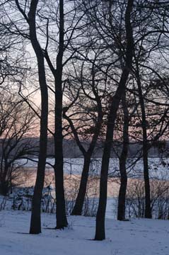
Lake Mendota Trees in Winter
Lakeshore Nature Preserve
University of Wisconsin-Madison
(William Cronon)
Visit your landscape throughout the year.
Pay attention to how the landscape changes each season. Note the species of plants or animals that you see at particular times of the year. It may be useful to talk to someone about the local ecosystem. Consider the ways in which the changing seasons might have affected other aspects of the landscape, such as the food people are able to eat, the physical location of structures such as dwellings, or the methods of human transportation. (Abigail Popp)
Understand the seasonal context of a landscape.
Visit a landscape in every season. Understanding the land in the context of its annual changes is a crucial component to a thorough reading; forests, fields, or streams do not pass a year in the stasis you might infer from the moment of a single observation. The animals, plants, weather, and land use activities you might observe can vary wildly from season to season. Acadia National Park’s Sand Beach is a very different place during the tourist throngs of July than right after a January gale. Ask yourself: “How are the components of my landscape (human, animal, plant, built) prepared to cope with the range of environments that the changing seasons provide? What migrates, what adapts, and what dies? How do immobile components like buildings or trees survive the range of conditions they may be exposed to in a given year?” A surprising amount of cultural and ecological insight may come from simply thinking seasonally. (Jacquelyn Gill)
Look at the landscape through a different lens.
When reading a landscape, people tend to look through a disciplinary lens that reflects their own education and experiences. This perspective can provide depth into your observations, but you should consider other ways of looking at the landscape that reflect different disciplines. Try to travel through your landscape with someone who is a specialist in a field other than your own. (Abigail Popp)
When reading American landscapes from a historical perspective...
documents such as land survey records, old photos, aerial photos and census records can tell you a lot about how the landscape has been transformed over time. These documents can best show pre-European vegetation histories along with information on the ethnicities of settlers and their occupations, which can provide insight into previous impact on the land. Good questions to ask yourself when assessing these documents are:
- Why did settlers choose this location?
- Does it have close access to transportation?
- Is it near an urban environment?
- What sorts of occupations did the settlers hold?
- Is the land conducive for agriculture or are there resources in the area that can be extracted for profit?
Local historical societies can prove to be a great resource in local history as can state land bureaus for information on historical development and planning in the area. Be sure not to ignore changing trends over time and ask questions on how changes in transportation may have spurred or wrecked certain industries and practices. (Brien Barrett)
The Portage
Portage, Wisconsin
(William Cronon)
Toggle the scale at which you frame your attention.
Watch the Charles and Ray Eames' film Powers of Ten. Download Google Earth, pick a place on the world map, and then zoom in and out. Notice the frame at which features become visible, recognizable, and discernible. Examine the legend of a map. At what scale has this representation been reproduced? Ask yourself about the significance of your map’s scale. Repeat this process in the field with your own eye. If your eyes are properly trained (and your lenses innovatively focused) the landscape can become meaningful at scales that you are unaccustomed to. (Stillman Wagstaff)
Look for many layers of meaning in a single place.
One way to think of a landscape is to see it the way that medieval exegetes saw sacred scriptural texts. For the medieval scholar of the Bible, there were four basic layers of meaning operating in the scriptures: the literal, the allegorical, the tropological (moral), and the anagogical. Reading identical texts in productively different ways requires two things: facility with different lenses, since you will find different things in the landscape depending on what you’re searching for, and belief that the text can teach several radically different lessons depending on the questions being asked. These textual approaches may also be applied to landscapes, with some modification. While you probably won’t try to read your landscape anagogically, the idea of a single text possessing features that can be understood according to several disparate senses is an idea that can be applied equally well to places and landscapes. Don’t forget that no single reading, no matter how original or insightful, is ever exclusive or comprehensive. (Stillman Wagstaff)
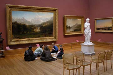
Family Studying Landscapes at Metropolitan Museum
(William Cronon)
Landscapes always express and reflect relationships: learn to recognize and understand these.
Landscapes express the networks, connections, and mobilities that drive the ongoing process of place-making. This dynamism means that landscape is situated in a relational process and should never be regarded as pre-given, isolated, or static. For example, a seemingly ordinary landscape of a Wisconsin farm near a small town has always been affected by in-state markets, inter-state transportation systems, international trade, global flows of goods, and so on. Accordingly, landscape should always be understood as manifesting spatial relations on multiple scales. (Po-Yi Hung)
Look for what may be concealed in a landscape.
Landscape can operate as a veil concealing the historical truth of socioeconomic conditions, and thus manipulate people’s perceptions of a place. For example, while the Meriter Hospital in downtown Madison is evidence of earlier urban renewal, behind this landscape “curtain,” it may also hide a story about the mid-twentieth-century displacement of an earlier poor and marginalized community. Here landscape is not only a present setting for the inhabitants, but also a veil obscuring earlier struggles or achievements in history. (Po-Yi Hung)
Think about the relation between landscape and modes of production and consumption.
Modes of production and consumption constitute many elements and spatial relationships that you will find in landscapes, so the ways landscape functions have changed in different times and spaces. These can be traced by thinking about changes in production and consumption. The drive-through facility in fast-food restaurants, for instance, may reflect a history of Fordist car production, highway construction, and mass consumption. These in turn have helped create the fast food culture now embedded in contemporary American landscapes and the lifestyles that go with them. (Po-Yi Hung)
Read landscapes from the perspective of representation
Landscape consists not only of the physical and material elements we encounter in a place, but also the representations of these things via texts, including arts, maps, and pictures. Understanding landscape in terms of its representations leads to questions about power and authority. Reading Aldo Leopold’s A Sand County Alamanc, for instance, readers experience landscape descriptions that represent Leopold’s choices, values, and beliefs. At the same time, readers may also discern more hidden codes and meanings, the assumptions imposed on landscape by the historical context during which a given representation was produced. (Po-Yi Hung)
Pay attention to the relations between landscape and identity
Landscape use and change could signify the beliefs and perceptions of different human groups about who should or should not belong to a particular place or community. Landscape thus contributes to an individual’s identity, which is often defined in opposition to other social groups. For example, different styles of farm houses and barns denote the different identities of ethnic immigrants in Wisconsin; the glacial geology combined with idyllic farm scenes to produce a “Wisconsin” or “Midwest” identity. In other words, landscape defines normative understandings of “self” and “other,” “inside” and “outside,” for various social categories and the human beings who dwell within those categories. (Po-Yi Hung)
Return to Top of Page
Getting Started
If you want to experience the landscape like a yogi, begin with an intention.
Choose one element that you wish to engage with deeply. If you know ahead of time what that will be, take a guidebook with you. Perhaps you want to know better trees of a particular landscape. Look at the leaves to help you identify the particular species. Get to know their names, since familiarity creates possibilities for richer connections. Notice any pattern to the ways trees are planted and consider what story this may tell about why any patterns may exist and what functions the trees may serve. By focusing on a particular feature of the landscape, you can become more deeply familiar with its interconnectedness to physical and cultural aspects of a landscape. (Cathy DeShano)
What is your purpose in reading the landscape?
Are you trying to generate broad questions, narrow down an area of focus, or examine particular features? Defining your purpose can guide you as you plan your itinerary, but it can also help you figure out what kind of research you need to do before you go. Leave yourself open to the possibility that the field trip itself might fruitfully disrupt your plans. (Michelle Niemann)
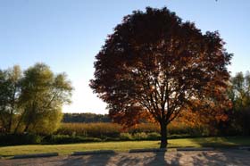
Autumn Tree Backlit by Sun
Lakeshore Nature Preserve
University of Wisconsin-Madison
(William Cronon)
Your best tour guide in a landscape you do not yet know is the sun.
Ask how the sun's location in the sky affects the look of the landscape around you. What flora has positioned itself in full sun? Which has made a niche for itself in the shade? How does the look and activity of a place change with variations in sunlight? How are dwellings (human and otherwise) constructed in relation to the day's dose of sunlight? Sunlight can reveal the characteristics of living things, such as the temperatures they prefer, their processes of drawing energy, and the qualities of their tools for navigation and hunting. It can also showcase the relationships between living things. Flowers and pollinators; predators and prey; winds and the boats, seeds, and winged things that ride them all have their preferred light of day. (Brian Hamilton)
If you want to see a landscape barefoot, leave your shoes at home.
Don't hesitate to walk in places that look uninviting – your feet can tell you a lot about the soil and vegetation under you. Dig your toes in, feel how easy or hard it would be to sink in roots, feel the heat or dampness or aridity of the ground, and use your feet as a way of connecting to the physical environment surrounding you. On a beach, sand sinks beneath your toes and leaves you working harder for traction. Feet will rarely encounter leaves; the lack of stability and poor nutrient availability limit plant growth. Soles are repelled and welcomed by turn in a pine forest – the bed of needles preventing undergrowth is soft until you step on a pine cone. Feet find much to complain about in an open field filled with thistles and sharp blades of grass, while manicured lawns offer up a much enjoyed domesticated pasture. (Emma Schroeder)
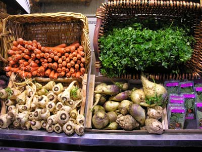
San Francisco Market
(William Cronon)
Tasting a landscape is important.
Taste (and make!) some of the traditional foods made on that landscape. Consider where the ingredients come from. Are they grown in that landscape, or were they brought from somewhere else? See if you can tell which plants and animals here are grown for food, and whether they originated in a different part of the world. See whether the food products remain within this landscape or travel to other landscapes. (Abigail Popp)
Read the landscape with more of your body than usual.
We almost always read landscapes with our physical bodies, coming to understand places by way of our senses. This engagement with the physical world is achieved primarily through sight, sound, hearing, smell, and taste. Usually, the knowledge we gain about a place is acquired by way of combination and conjunction of several senses. However, our sense of sight (and the visual elements of landscapes) is often privileged over other ways of knowing a place. When in a new place, ask yourself: what can I know about this landscape with my eyes closed? What does the landscape you are considering smell like, sound like, feel like, even taste like—and what are the sources of these smells, sounds, textures, and tastes? How and why are these sounds and smells produced? Our ability to sense things that can’t be seen also functions as a useful metaphor for history itself, the search for ghost traces left in and upon things by vanished forces. (Stillman Wagstaff)
How do I learn from the locals?
Sometimes the local people serve as a better (or at least more colorful) source of information on the landscape than the guide books, especially about the history of the town and the importance of local landmarks. Here are a few tips to making the most out of your talks with local people:
- Engage and listen.—Your vacation or travels will be much richer if you make an effort to meet the local people and listen to what they have to say about the place that they are attached to.
- Older is better.—The most colorful stories come from the area's inhabitants with the longest history there. Stop at a spot that looks like there are a lot of locals and listen to people's stories.
- Have some questions in mind.—You will get the most out of your interactions with people if you at least have some idea of what you are looking for in the landscape. Ask questions about roads going up, development in the area, how people used to get around, etc.
- Look for local leaders—Elders, park officials, librarians, or local politicians probably have the best grasp of the local history. (Kevin Gibbons)
Your Neighborhood: Borrow a Cup of Sugar
You just moved into a new neighborhood. Find the oldest neighbor on your block and go borrow a cup of sugar. She might live in the house with the birdfeeders in the backyard and a cherry and apple tree. This neighbor is retired and has time to talk. She happens to have built the first house on your block. She knows how many deer live in the wooded park and which ones eat her rose; how old the trees are and that a precious few came from the farm which once stood where this subdivision is now. When the bulldozers came, she dug up a few baby sugar maples and planted them and they light the fall landscape in gold and orange. In the sixty years since she left Germany, she's seen the local climate change: she'll show you flowers in her garden that could not grow in Wisconsin before. She'll also tell you how the neighborhood has changed ethnically, and that she is not happy about "those loud people" in the neighboring apartments. And then she'll send you home with a jar of raspberry jam she's made. (Trish O'Kane)
Taliesin Landscape
(William Cronon)
If you want to read a landscape but have no idea how to start, try these strategies.
Look at the physical features of the environment, such as geology, soil, or water. These items can provide clues about the types of creatures that have lived in the area and why. In Wisconsin, glaciers determined much of the state’s surface geology. When the glaciers retreated, for example, they left behind glacial till, gravel and sand. These affect soil and can influence what crops, if any, will grow well in a region. Water also is an important resource to understand because it provides transportation routes for humans, as well as sources of energy. Trade often took place near water sources because loading and unloading was easier for merchants. As society evolved and new means of traveling and producing goods developed, businesses and towns that relied on water may have been abandoned or taken on limited roles. Watch for dilapidated structures or other signs that bustling activity may once have taken place in a landscape. (Cathy DeShano)
Understanding patterns from your past allows you to ask the right questions in a new environment – place what makes sense to you, and then dive into what looks out-of-place.
These are the features to look up on maps; identify using dichotomous keys; locate through talking with local residents. Feel rocks that look strange; wonder at new farm building styles; ask why all the roads are in such perfect order. It is in balancing your known environments with the unknown, then going back again to what you thought you knew, that you see a lot in a landscape. (Emma Schroeder)
In a new town—clueless and guideless—what do I do?!
Reading a landscape does not have to entail lugging around guidebooks, binoculars or paying a tour guide. Here are some questions to try to answer that will tell you a lot about the local people and why the landscape is set up as it is:
- What do people do to eat and/or earn income?—Fishing and mining towns and villages normally have houses that are close together because the people are going out to use the same resource and do not need to spread their plots far apart. Farming communities would show populations more spread apart. If there are many roads and railroads and a variety of businesses, the local people may work in manufacturing, trading and transportation, or tourist activities. These activities have a huge effect on the landscape and how it is shaped over the years. It is also interesting to not different types of buildings to see. Can you tell just by driving, riding, or walking through the town or city what the local people specialize in?
- Where is the food coming from?—Check out the local markets and find out what people are buying and eating. Is it found locally? How and where is it raised, farmed, or gathered? Is there a farmer’s market? If so, try to visit it and speak with the farmers.
- How do people get around and how did they used to get around?—American suburbia houses multiple automobiles per family in garages. Early 20th and late 19th century households would not have garages, unless they have been added on. Early inhabitants of the place may have used public transportation, ridden horses, or walked. If you have trouble finding parking, you may be in a historic area. Was it developed before the widespread adoption of the automobile? These differences affect how areas expand and how local people interact and alter the landscape.
- What do people use as building materials?—Look at the houses and other buildings. What materials are there? Where are they coming from? Are the houses mostly wood or brick? Are the bricks the same color as the soil?
- What is the religion and where are the places of worship? The majority of the people in most American towns will be Christian, but the particular denomination is important. Are there Lutherans of German or Scandinavian ancestry? Do you see many Methodist churches that might be of English or German descent? Are there any large Catholic cathedrals or churches, and were they first built for the Irish, Italian, Polish, or other immigrants? Do you see any Russian, Greek, or other orthodox churches? How many synagogues, mosques, Buddhist temples, or Hindu temples are there? What does that tell you about the population, and when did those people arrive?
- What do people do for recreation? Are there many gymnasiums or people running around? Do you see anything about snowmobile paths or desert dune buggy rides? Knowing what people do for fun tells you a lot about their culture and their relationship with the land. (Kevin Gibbons)
Return to Top of Page
Rocks and Clouds, Plants and Animals
Recognize that the shape of the land has a history.
It is easy to take the ground for granted. Because a landscape’s lifetime is so much longer than our own, land usually seems timeless and given. If you know nothing about geology, begin by thinking of the ground itself as a historical document: glaciers, water, and the slow or seismic shifts of tectonic plates have shaped every piece of earth. Notice the form of the landscape and inquire about the history that this form records. Geology does not simply label rocks and name phases of the distant past; it also tells stories. (Michelle Niemann)
Glacial Moraines & Drumlins
Between Madison and Milwaukee in Wisconsin
(William Cronon)
View the landscape through the eyes of a glacial geologist.
The Pleistocene ice sheets retreated from most of North America thousands of years ago, but the last ice age is still fresh in the geologist’s mind. In glaciated regions, few forces (natural or anthropogenic) have had a similar shaping power on the land. Landforms, soils, lakes, and rivers were all influenced in some way by the ice; glacial deposits in part determine where certain trees can grow or what makes good farmland, and glacial lakes have directed the migratory paths of birds for millennia. Without glaciers, there would be no Long Island and no Great Lakes. Beyond simply thinking of glaciers as the bulldozers of Nature, the glacial geologist appreciates that landscapes change over time. The events that took place long before recorded history have a powerful influence on the trajectory of human relationships with the land. To learn more, find the surficial or glacial geology map of your region, and compare it to maps of settlement, or farmland. If you can, find an expert to tell you about the landforms, soils, and sand dunes underlying the grass beneath your feet. (Jacquelyn Gill)
To understand the topography of a hilly region, try to determine if glaciers once covered it.
Examining a topographic map can help in this endeavor. Is hilly or steep land clustered in an area of high elevation that diminishes as one travels away from that axis? Or is there a wide band of roughly equal shaped and sized mounds that are the result of a glacial deposit? Well-defined watersheds indicate the cutting process of water eroding unglaciated mountains over time. Water that is “less certain about where it is going” features meandering streams and numerous wetlands as a result of the scraping activity of glaciers. (Steve Laubach)
If you want to read the glaciated geology of a landscape...
the best starting point lies in the understanding of how glaciers work. In short, the repeated freezing and thawing of accumulated snow in a certain area will compact the amassing precipitation into ice, and over time, this ice is further compacted under the immense pressure of its own layers and will eventually compress itself into glacier ice. In response to both gravity and its own pressure, the glacial ice deforms and causes the glacier to act like a conveyor belt, where it will pickup and deposit sediment as it flows and carves its way through a landscape. As a result of this, the glacier will deposit debris at its terminus, or end-point, and if the glacier has ceased to advance, these deposits will accumulate into a moraine (specifically a terminal moraine if at the terminus of the glacier) that is highly visible as the glacier retreats. One only needs to look at a topographical map of southern Wisconsin to see the effects of a glacier, as the western half of this area—known as the "driftless area"—shows the characteristics of an unglaciated landscape and the flatter land to the east conveys the geological aftermath of the last glaciation period in the state. The ridge that separates these two regions is, in fact, the till of the terminal moraine of that glacier. (Brien Barrett)
To differentiate between sandstone and limestone, look at the shape of stones creating an outcrop.
Limestone has a building-block quality, with fissures running both horizontally and vertically. In contrast sandstone is smooth and curvy; one can imagine ancient beach dunes with their tumbling, grainy sides. (Emma Schroeder)
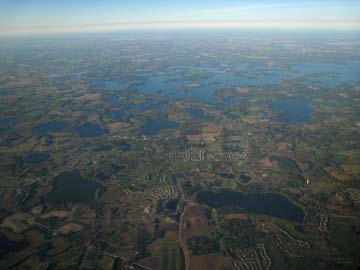
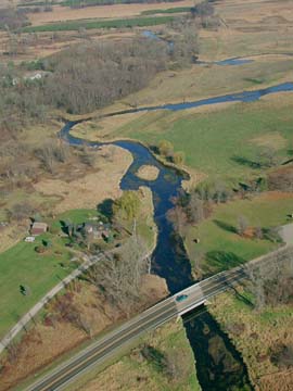
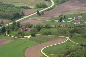
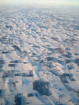
Aerial View of Lakes, Fields, and Subdivisions
West of Minneapolis—St. Paul, Minnesota
(William Cronon)
Think about where the water goes.
When rain falls on the landscape, look at what kind of land it is falling on (pasture, cropland, urban areas, etc.). Different types of land will have different effects on water quality. Notice where the rivers, streams, and lakes are situated and where they go. Try to imagine how the pathway of water might have been shaped by humans. Are there dams, diversions, ditches, gullies, or gutters? What might those things tell you about how humans have used water in this landscape? (Abigail Popp)
What would an ecologist see here?
Ecology is the study of the interactions of organisms and their natural environment, so an ecologist would look at what life is present in the area and how the land supports this life. What are the plant species present? Are they fed on or do they serve as habitat for animals or fungus? If there are herbivorous animals (deer, hogs, iguanas, etc.), what plants are they eating, and are there any carnivores that control these populations? What are the climate type, soil conditions, land cover, and geology that support this ecosystem? A passionate ecologist would read ahead of time about the composition of the ecosystem or ecosystems that she would be visiting to know what species to look for and then look for the relationships of those species and try to understand how that system supports life. (Kevin Gibbons)
Trees Marking Abandoned Fence Row
Lakeshore Nature Preserve
University of Wisconsin-Madison
(William Cronon)
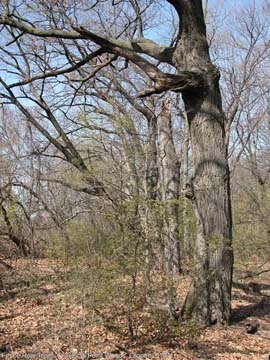
To learn about a forest’s ecology, study its topography before its trees.
Is the land sloped or flat? If steeply sloped, look for differences in the vegetation on the north versus south slope, or on the ridge versus in the valley. If flat, search for areas where water collects and look there for changes in vegetation. Practice judging whether the diameter of the largest trees is large, medium, or small. If there are large trees, are there several of them scattered throughout the forest, is there a straight row of large trees, or is there a single large tree? If you notice a row of large trees surrounded on one or both sides by significantly smaller trees, look for evidence of old fencing (such as barbed wire) that may have once separated a farm field from a forest. After determining the age distribution of the trees, examine the geometric growth patterns of their limbs. Do trees have thick lower limbs with leaves that indicate past openings for sunlight? Do they lack lower limbs indicating fierce competition for light below the canopy? (Steve Laubach)
Pay attention to what the trees record about the history of the landscape.
Trees are particularly helpful recorders of landscape change; anyone reading a forested landscape should realize that they have opened the book in the middle, and that the beginning and the end have murky definitions. Start simply when looking at the trees: are they all the same diameter, or a mix? Clusters of trees the same age suggest past land-clearance or a large disturbance. How open is the canopy? Are the trees conifers, or deciduous? Ask yourself about species composition, which trees seem to be dying or thriving (if any) and whether there are seedlings (and what kind). Look for individual trees that may give clues to the landscape’s history (open growth forms, burn scars, tip-ups, woodpecker holes, insects, deer browsing, chain scars). As one of the more long-lived components of a landscape, trees can offer historical evidence of past climate change, human activity, animal presence, or disturbance. Don’t merely catalog the kinds of trees you see on the landscape; think about why they’re growing there, and what they tell you. (Jacquelyn Gill)
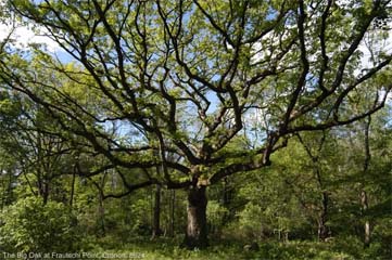
Open-Grown Oak Now Surrounded by Younger Forest
Lakeshore Nature Preserve, University of Wisconsin-Madison
(William Cronon)
A tree's reach for the sun tells you the history of its physical environment.
Trees depend on sunlight for survival and, unlike when you grab for a cookie, a tree commits to a branching direction and cannot change structure rapidly. Branching patterns therefore indicate the direction a tree reached in the past to get as much sun as possible. If a tree has branches primarily on one side of the trunk, something in its past limited the sunlight on the other side (other trees as on the edge of a stand, an old structure now removed). Branching structure will tell you how close a tree has historically been to its neighbors: if you are currently in a forest yet a tree has low, wide-spread branches, the tree used to stand in a field or savannah where it had the ability to stretch out. Called "Wolf Trees" these individuals spread their branches effectively "preying" on saplings by blocking light to the understory. A tree with branches clustered at the top of its trunk indicates that the tree fought for sun its whole life within a forest, and so had to grow up rather than out. (Emma Schroeder)
Is the forest primary or secondary?
Woodlots, timber plantations, or reforestation areas can be distinguished from naturally forested areas because the former will likely be arranged in rows and have a limited amount of underbrush. Natural forest areas are usually designated as primary (unaffected by human activities or other disturbances) or secondary (affected forest that has regrown or continues to grow with human presence). Areas of the various kinds of temperate forests are harder to classify than tropical or temperate rainforests (like in the Northwest) because the composition of trees may not be the same as it was a few hundred years ago, due to human impacts. Two telltale signs of an old, healthy forest area are a large amount of underbrush and trees that are of a variety of ages. Also, estimating the ages of the oldest trees helps you to age the forest. Look up in a field guide the mature width of the species of trees in the area and base your estimations off of that. (Kevin Gibbons)
To learn about a forest’s wildlife, use all of your senses.
With the help of binoculars, field guides, and local experts, learn to visually identify the most common animals. Starting with a small cast of characters, observe them closely, even those gray squirrels that you have walked by thousands of times. Next, move to animal sounds. Are you hearing insects, reptiles, birds, or mammals? For the most common groups of noise-makers can you distinguish between different species? With the help of online audio recordings and locals knowledgeable in animal sounds, try to learn the different “instruments” in the “animal orchestra.” Finally, try to develop your olfactory skills. The most common animal smells in our area are skunk spray and fox urine, and both have a similar smell. Ask a knowledgeable local to take you for a hike to differentiate between the two. (Steve Laubach)
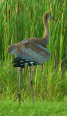
Sandhill Crane
Lakeshore Nature Preserve
(Glenda Denniston)
Make a Morning Coffee Date with the Birds
To read a park landscape, have coffee there weekly. Steal out just before dawn, the hour of Aldo Leopold, with a thermos and binoculars. Now sit at the highest point, perhaps an old Indian mound, and listen as park residents reveal themselves. In the early summer you may hear a cacophony of cardinals, warblers, meowling catbirds, buzzing cedar waxwings and a great blue heron croaking as he soars over your left shoulder, pterodactyl-like, on his way for a morning fish. You might catch an aerial show of dive-bombing swallows or a pack of irate crows pursuing a flustered teenage red-tailed hawk. After a few weeks, you'll notice a tiny hummingbird, who weighs so little that you could stuff him and seven of his brothers into an envelope and mail them with a first-class stamp. He hangs out in the same dead tree, every morning for two months. As the sun rises, he shows off his ruby throat before beginning a daily round of 1,500 flowers. You are a guest in his territory. Check out Cornell University's website "All About Birds," for sound files of birdsongs and photos to identify your feathered neighbors. (Trish O'Kane)
Ecologists Grow Wings to View Habitat Fragmentation
Grow the wings of a brown-headed cowbird, a blackbird with a 12 inch wingspan. This bird is the planet's greatest virtuoso: its liquid glissando spans four octaves in less than a second. It is also what biologists call a "brood parasite." The female cowbird does not build her own nest; look for her perched silently in the treetops as she surveys the landscape for other nests. When a chipping sparrow or wood thrush leaves her nest, the cowbird flies in, pushes out an egg or two, and lays her own. Foster parents from over 200 species end up raising voracious baby cowbirds that are often bigger and more aggressive than their own young.
So if you are a cowbird flying over a new landscape, you seek chopped-up territory-- patches of land divided by road and fence. Human fragmentation of the landscape has created much more "edge" habitat --the ecological term for where different habitats meet, such as a backyard and woods, a field and woods, a subdivision and a meadow. Certain species like cowbirds thrive on these edges at the expense of other species like wood thrushes, hurting our biodiversity. (Trish O'Kane)
If you want to study the lizards in a landscape, you'll need to catch them.
Choose times with mild temperatures— the late morning or late afternoon—and look in places that are protected yet still catching sunlight. Affix a short length of string or dental floss tied in a loose slip knot to the end of a pole. Move the knot toward the lizard head-on with minimal side-to-side motion, as lizards have poor depth perception. Slip the loop over its head slowly, then quickly jerk the knot taut with an upward motion. If you miss, most lizards will let you try again. Once you've lassoed it, be careful not to grab it by the tail and then rest it in a cool place (but not a freezer) to make it easier to later take its measurement, note its coloration and scale pattern, and find it in your field guide. Be gentle, don't hurt, and return it to freedom when your conversation is done. (Brian Hamilton)
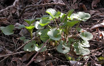
Garlic Mustard (invasive species)
Lakeshore Nature Preserve, University of Wisconsin-Madison
(William Cronon)
Are these plants and animals supposed to be here?
Recognizing invasive/exotic/introduced species is critical towards reading a landscape because that knowledge reveals to the reader whether the landscape looks like it is "supposed" to look and what forces have contributed towards its current configuration. A few tell-tale signs that the species in question is an exotic:
- High Density—If you see a particular species completely covering the landscape without any assistance from agriculture (e.g. kudzu and lovebugs in the Southeastern US, certain species of cattails and reed canary grass in the wetlands of the Midwest, garlic mustard in midwestern forests, and cane toads in Australia), then it is quite likely that it is a non-native species that has been successful in the region you are visiting.
- Common Along Paths—Many "weeds" will show up frequently along footpaths and roads. Often many native plants will also show up because it is an opportune place for fast-growing plants to find sunlight, but if you see one particular species growing on either side of a path in high densities, you are likely looking at an exotic plant. (Kevin Gibbons)
Return to Top of Page
The Rural Countryside
If you want to consider how rocks influence rural human settlement, study roads and buildings.
To begin this endeavor, you will need a topographic map to obtain a "bird's eye" view of the area. Learn how to interpret the elevation lines on a topographic map so that you can develop a three dimensional image of the landscape. Maps with other emphases will also be necessary, such as highway and geology maps. If the area is hilly, identify the highest location with an unobstructed view on your topographic map and visit it with a pair of binoculars. Take a look at roads: are they straight or winding? Is their grade gentle or steep? What types of stones are common in the area's roads (especially gravel on highway shoulders) and buildings and how does that relate to its rock deposits? (Steve Laubach)
Agricultural landscapes can provide significant insight into an area’s resources, economy, and history. When visiting farm country, first consider the time of year. This will help you determine what part of the growing season is underway. Although seasonal change determines the planting cycle, climate determines much of what is produced in an agricultural landscape and furthermore, how it is farmed. When visiting a farm, survey the size and type of agriculture at play. Consider the local market for the animal or plant material being cultivated as that aspect may have a significant impact on the size and condition of the farm. Notice monocultures- are adjacent farms are growing the same crop using similar practices? This observation might lead you to believe that the region has a specialty crop. Think about how products move from farm to market. (Liese Dart)
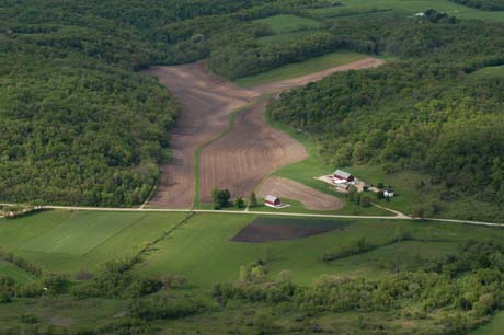
Southwestern Wisconsin Farm Landscape
(William Cronon)
If you want to make sense of a farm...
Notice the house. Where is it located? Farmhouses in cold climates historically were built near or across from hills to shelter farming families from harsh winter winds. Shade is nearby to keep families cool in the warm summer heat. Active farmers live close to their barns, so they have quick access to their animals. Barns on working farms are located near the road, so sellers can collect milk easily on a daily basis. You often can tell an inactive farm by the home’s location. Homes built on top of ridge-lines are modern-day signals of families looking for a pastoral retreat from urban life. Ridge-top farmhouses may provide people expansive views, without concern for natural means of sheltering families from weather. Alternatively, ridge-top farmhouses may be surrounded by trees that were artificially introduced by individuals, designed to provide privacy from passing traffic. (Cathy DeShano)
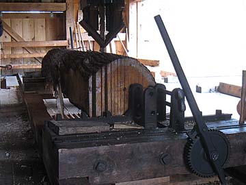
Saw Log on Water-Powered Vertical Muley Saw
Wade House Historic Site, Greenbush, WI
Wisconsin Historical Society
(William Cronon)
You'll know when the board was cut when you find the saw-marks in the wood.
Hand sawing, most common in the United States up to the middle of the 18th century, leaves rough, uneven lines, usually cutting a diagonal angle across the edge of the timber. Water-powered sawmills began to appear in the colonies in the 18th century, and you can identify the mark of the early sawmills by looking for columns of uniform cuts, at perfect ninety-degree angles to the long edges of the wood. While the exact date of the invention of the circular saw is contested, curved saw markings on a piece of wood in the United States most likely date from after 1840, with the earlier markings less tightly curved than those made by later (and modern) saws. (Brian Hamilton)
To learn more about landscape history, learn how to read the farmstead.
Consider the landscape. What is the slope? What are major land features? In broad land-type categories such as field, wetland, water body, forest, lawn, building, identify the major features of the farmstead. Then consider the placement of each of these relative to slope, sunlight, wind, and moisture. A house built either in the crook of a valley versus on a hilltop with a view or on a wet lowland field might give some indication of the age of buildings, or the wealth and class of the owners. Look at the buildings and think about how many floors they have and how they are shaped. Do they have basements or cellars? How were they built? Look for roof features, chimneys, awnings, and porches. You can see building additions by noticing variations in style or material or weathering. (Genya Erling)
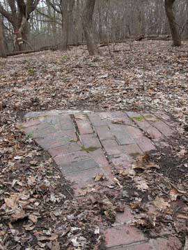
Brick Path as Last Remnant of Abandoned House
Lakeshore Nature Preserve
University of Wisconsin-Madison
(William Cronon)
Look for signs of past human habitation.
Landscapes retain evidence of historic human settlement; these “ruins” can be anything from an 18th century limekiln in the forest to an abandoned factory around the block. When exploring regions where abandoned farmlands were reforested in the last century, look for signs of nurture scattered amongst nature. Old stone walls may have once surrounded pastureland, and the bright red-orange berries of the exotic Japanese barberry may mark the location of an old garden (the barbs kept out sheep, cows and deer). If you find apple trees in the forest, look for the stone cellar of an old farmhouse nearby. Signs like these point to a history of land use that may otherwise be lost to casual observation, but which are a part of the forces that shape the landscape’s experience in time. Recognize that the landscape has undergone many uses and experiences over time, and that what you see now is still influenced by the landscapes of the past. (Jacquelyn Gill)
Agricultural buildings and agricultural infrastructure can also tell a lot about a certain landscape.
The stories behind why farmhouses were built the way they were greatly differ from those of other houses built in rural settings, as many farmhouses are built with practicality in mind and many rural homes are built around the home's or area's aesthetic beauty. Farmhouses may not have all the amenities to protect themselves from the array of weather that is common in rural areas. As a result of this, farmhouses are often built to utilize and protect itself from Nature, as they may have southward-facing windows for heat-preservation purposes and are built in valleys to protect themselves from the elements. Also, when you look at a farm, the location of the farmhouse can tell a lot about what type of farmer is on the land. Historically, dairy farmhouses are situated closer to arterial roads as the highly perishable milk that they produced needed to be easily picked up and delivered to the market before it spoiled. Silos on farms can also convey the era of which they were built and the farmer's adoption of new technologies, as overtime improvements in technology drastically changed the efficiency of producing silage in these buildings. Also, it is good to ask questions dealing with how a farm gets its resources:
- Is there a well on the property?
- Does the farm irrigate?
- If so, where is the water source from which they are extracting water?
- In addition, if a farm keeps livestock, how do they house the animals?
- Are they allowed to roam or are they kept in large encapsulating structures? (Brien Barrett)
Field and Old Road
Lakeshore Nature Preserve
University of Wisconsin-Madison
(William Cronon)
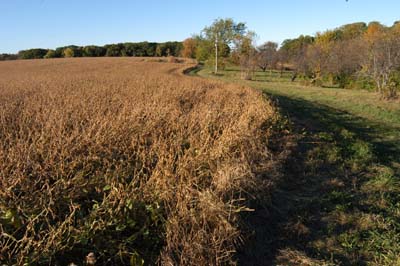
If you want to read the rural landscape, look at the fields.
How big are they? What shape are they? Is it pasture? Row-crop? Are there furrows, bogs, or terraces? Are there contour strips? Is the plant that is growing a monocot or a dicot? Is it woody or perennial? Look at the leaves and the flowers. How much variation is there? Is it edible? Look at the soil and the water. In the Midwest, if there are furrows and especially if there are large round fields, it will likely be potatoes. A monocot in a wetland will be rice (if you are farther north), but a dicot in a similar environment is more likely cranberries. Monocots on dry flat fields are corn or straw, and in some places wheat, barley, or rye, while dicots are probably soybeans or alfalfa. Occasionally one sees vegetables, but in Wisconsin, as opposed to California, these are usually small or niche farms, or domestic gardens. (Genya Erling)
Agriculture has proved itself to be one of the main ways in which humans have shaped landscapes.
The presence of potatoes as a main crop in a field can tell a much different story about the land than a field of corn or grazing cattle. Also, the type of livestock raised can tell many stories about the farm. If a farm raises or houses only horses, it may be that the land is a sort of a "hobby farm," and its owner uses the property for vacation purposes only. Another important factor to look at is how has agriculture affected the areas that surround the farms. Lands that are unable to be plowed are often left to grow in their "natural" state, and, over time, usually develop into densely forested areas. Historically, however, these lands may have been subject to routine burnings (by either native peoples or natural forces), and may have never fostered to anything other than prairie. Also, grazing ruminants may allow for a selection of a certain species to proliferate within an area, as their taste preferences have a lot of control over what species grow around the areas in which they graze. It is also important not to forget that farms were plotted out before the invention of fuel-powered tractors, and plows were often moved via animal labor. With this in mind, how has the allocation of plowable lands to accommodate animals, which are not easy to maneuver, shaped agriculture plots in America? (Brien Barrett)
Catalpa Tree Grown Over Old Fence
Lakeshore Nature Preserve
University of Wisconsin-Madison
(William Cronon)
Remember that farming helped create the woods.
Though wooded patches often seem like bits of nature left between crop fields, remind yourself that most forests in the United States, especially east of the Mississippi, have grown up recently. Woods may have come back in an area that was once logged, or they may have taken over a prairie that fires once kept free of trees. (Michelle Niemann)
To better understand the cultural landscape of an area, learn to read its food system.
The food system shapes the cultural landscape continually, so learning to read it will provide insight into a place. First, look for the food. What and where do people eat? Then consider how the food is acquired. Is it grown in gardens at home or out in nearby fields? If the food is being purchased, find out where. Can you get it from street vendors or outdoor markets? How big are the stores and what products do they offer? Consider the processes involved in the entire system. How is the food processed and transported, if it is? Look for storage and processing facilities like grain elevators and cheese factories. What is the energy source? What is the water source? How many ingredients are involved? Consider road, rail, and shipping networks. Both package sizes and parking lots will tell you something about the environment. Finally, look for evidence of waste streams. What happens to leftovers and packaging? How is it managed or stored? What wastes are apparent? Look for abandoned or converted facilities and stores, too, for a clue about changes over time. (Genya Erling)
Some of the best-known places are landscapes that have been altered for human activities such as hunting, boating, skiing, and other recreational sports.
Recreational areas are planned in consideration of climate and vegetation to maximize the economic and sporting success of an activity. When visiting these types of areas, notice which parts of the area are left as wilderness. Ask yourself: where are the trails, ski lifts or put-ins and what effect do those structures have on the landscape? Is the sport is low or high impact—is the land managed for one particular outdoor activity? Less management and lower levels of human traffic often leads to less ecological degradation of an area. Look for signs that advertise the area’s unique qualities—this can increase the number of visitors to a recreational spot. (Liese Dart)
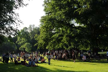
Englischer Garten
Munich, Germany
(William Cronon)
Why do these parks exist?
Natural areas near human settlements are there for a reason. In many parts of the US, many wilderness areas are there because of local game or duck hunting. They might also be conservation areas or tourist destinations. Investigate areas to find out:
- Who is managing the area?
- When was the area declared a park and why?
- If it has been designated for species conservation, which species?
- What are the main attractions?
These bits of information will also lead you to more in depth information about the area from the government department or people who manage the area. (Kevin Gibbons)
Return to Top of Page
Cities, Towns, and Infrastructure
Find the center of town, if the town has a center, and begin there.
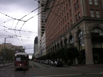
Walk, bike, or drive slowly along major and minor routes through town and notice how the town’s layout shapes and directs your travel. Make frequent connections between what you see on the map and what you experience on the street. How are roads named and how do those names relate to their current function? (For example, does Main Street seem to be populated and vibrant? Does Canal Street run along a canal?) It is helpful to get to know the lingo: what do locals call the four-lane highway on the outskirts of town, lined with malls and restaurants, clogged with traffic and stoplights? If it’s called “the bypass,” you know its original purpose and can infer how its function has changed. (Michelle Niemann)
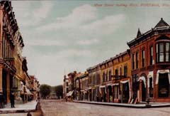
Main Street, Portage, Wisconsin
Undated Postcard
(Fred Galley Collection)
On your next visit to a new city, take a stroll along Main Street and examine its buildings.
Try to determine how the town receives and ships goods. Look for a navigable river, railroad track, or highway adjacent to or part of the main street. After talking with long-time residents, compare present receiving and shipping patterns to past ones. Was the town founded along a river or railroad that it no longer uses for shipping and receiving goods? Are there remnant buildings or structures that indicate this? (Steve Laubach)
How a store caters to customers is the key to dating a commercial district.
How do you get to your favorite store? If you drive, you assume that there will be adequate parking. If you bike, a bike rack is always appreciated. Architects design commercial buildings to accommodate customer transportation needs. Thus storefronts built adjacent to sidewalks with little or no parking catered to people walking through commercial districts—pre-personal cars, pre-1920's. Stores built slightly away from the road with parking for about 10 cars were constructed during the emergence of personal cars (1930s-1940s); these stores flaunted new eye-catching signs as a way of drawing in fast-moving traffic. As the personal car came to dominate the American transportation landscape, parking lots grew in response—resulting in the car-dependent strip malls prevalent today with signs that can be read by people speeding by on the highway. (Emma Schroeder)
Reading the Midwestern downtown as a landscape can help you hone your ability to establish a sense of place, and these tips can help you do so quickly and easy.
First, ask yourself how the downtown area of the city relates to nearby water resources. Most Midwestern cities were founded in an era when water resources could not be easily pumped and irrigated across long distances. These nearby water resources, in turn, are an important window into how the town operated within the local or regional economy, as most waterways were important transit systems for goods and people during the 19th century. Second, pay attention to the kinds of buildings that constitute downtown. This can be a tricky enterprise because so many 19th century buildings have not survived the various urban development trends of the past several decades. But architecture and storefronts, among other things, can reveal important clues about a city’s social life, institutions, and sense of identity. Third, head toward the center of downtown and make a note of what you find there. Lining most courthouse squares and town halls, you’ll find many local offices of government alongside many important historical markers, like the proverbial soldier monument. These town centers can be read as epicenters of the town’s collective memory. Making note of the figures remembered there, the aesthetics preserved there, can go a long way in establishing what the place means to local residents. (Jesse Gant)
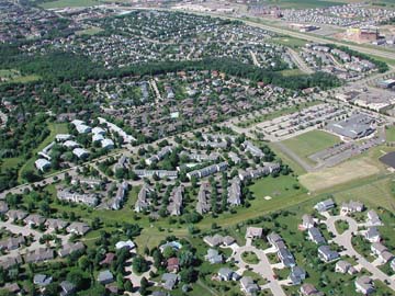
Suburban Subdivisions
West Side of Madison, Wisconsin
(William Cronon)
Since the 1940’s, the subdivision has been one of the most common techniques for developing suburban communities.
While many older subdivisions contributed to the graceful expansion of existing towns, more modern neighborhoods are often built upon subdivided farmland well outside of a town or city boundaries. When visiting a neighborhood subdivision you should consider whether it is integrated into the locality or built to stand alone. Note whether the streets are built as throughway connectors or as dead-end cul-de-sacs. Is there evidence that the subdivision has distinct social class boundaries or are there a range of homes styles and sizes? If the neighborhood is fairly new, how old are the trees? These questions and others could be clues to the functionality of roads, the socioeconomic level of an area and the age of a neighborhood. (Liese Dart)
Remember what you already know about houses.
If you have driven through suburbs in the United States, you can tell the difference between, say, the large suburban homes of the 1990s and 2000s with their multi-car attached garages and the ranch houses that became popular in the 1940s and 50s. Use your familiarity with types of houses to look at the landscape systematically. Where are newer and older suburbs in relation to each other? Are they interspersed with older farmhouses and crops? Look for patterns, and then ask what you can infer from those patterns. (Michelle Niemann)
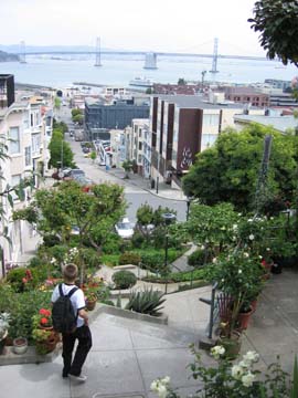
Descending Steep Walkway in San Francisco
Looking Over Built Environment of City
(William Cronon)
If you want to explore the influence of transportation in urban landscapes...
Begin in the city’s center. If you’re not sure where this is, look for closely built homes with narrow spaces between them. Homes whose grounds maintain much of their original design aren’t likely to have a garage, since automobiles didn’t exist during the early days of many urban places. Streets in city centers are likely to be narrower than those of suburbs, which become wider as a city’s population and traffic increases. As you move away from the city center, notice when and where garages exist. Older homes may have sheds set in back of the home, in larger yards, where families could store a car. As automobiles became part of most people’s daily lives, families had their one-car, then two-car garages, attached to the home, so they could avoid bad weather and quickly carry items to and from the car. As you observe these changes, also consider how they influenced social relationships among residents, as well as their interaction with the landscape. Autos may have influenced pedestrian traffic and safety along city streets. Garages and large yards could affect people’s connectedness to people and spaces. (Cathy DeShano)
Infrastructure can reveal a lot about different landscapes.
Often the quality of certain infrastructural elements can provide insight into not only the amount of funding allocated to it, but also who is behind that funding. A federal interstate highway receives drastically different funding when compared to gravel county roads, and the difference in quality is easily seen—and felt—as a major arterial road merges with a local road. In regards to electric power transmission, large, high-tension power lines—which connect power grids and distribute power to local sources—can often signify a sense of danger to consumers and tend to be constructed in areas where property values are low. If built in a more developed/urban area, high-density, lower-income housing is usually near these lines. When traveling in rural areas, one can often notice large natural gas tanks situated behind houses. Due to high economic costs of piping in the gas to these homes underground (which is more feasible in urban areas), rural home owners often have to invest in external natural gas tanks to provide their natural gas needs. (Brien Barrett)
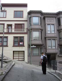
Mighty Steep Street
San Francisco
(William Cronon)
A road shows you its age in its shape.
If you see that a roadway that runs straight up a steep grade, you'll knows it was built for automobiles and the convenient calories of gasoline. Humans and their domestic animals don't want to waste precious food calories on climbing hills if they don't have to. Look for more attractive options, roads that wends around hills or stick near valley bottoms, remaining as flat as possible, and you might find a road that trod before—perhaps well before—the 20th century. (Brian Hamilton)
To see beneath sidewalks, look for spray paint.
Before digging, municipalities and utility companies trace the vast array of conduits below the street in color-coded lines. Generally, blue paint marks water pipes, green marks sewage or storm-drain ducts (sometimes one and the same), yellow marks natural gas lines, red marks electrical cables, and orange marks communications, such as fibre optics and buried telephone wires. To guess at the direction liquids are moving through pipes, remember that most sewer systems and water networks are powered by gravity. Sewage and storm water will flow downhill away from buildings and street drains, emptying at relatively low elevations. Drinking water will flow down from a water tower (in flat locales) or reservoirs situated at relatively high elevations. (Brian Hamilton)
To interpret infrastructure, begin by tracing light bulbs to their power source.
Try to determine from observation (e.g., of windmills) and conversations with knowledgeable locals how electricity is generated and what that tells you about that region's resources. For power lines, pay close attention to the location of high voltage transmission lines versus lower voltage retail lines. Why are high voltage lines in one location and not another? (Steve Laubach)
Electric Trolley and Overhead Wires
San Francisco
(William Cronon)
Power plants and transmission lines exist most anywhere people live.
This applies to the United States and most other affluent countries that have developed a national grid. However, many less developed countries substitute biomass for electricity in rural areas. Electricity grids are composed of power plants (hydro, coal, nuclear, wind, and natural gas), transmission systems, and distribution lines. Electricity infrastructure can hold many clues to a locality’s resources and their relationship to the larger landscape. When visiting a locality, you should consider how the area’s electricity is created. Is it produced locally or far away? Do you see any power plants or a network of high voltage transmission lines in your view? If you visit a local power plant, expect to learn about the geology and geography of the region. For example, windmills are usually sited on windy ridge tops and require wide open expanses. Coal mining is evidence of a unique geologic landscape created over hundreds of millions of years by fossilized peat. (Liese Dart)
Return to Top of Page
Special Places
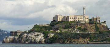
Alcatraz Island, San Francisco
(William Cronon)
An element of landscape reading that is often overlooked are ghost landscapes.
Ghost landscapes are clues left behind from the past that show what a previous landscape may have looked like and how it was altered to achieve its present state. They can be as noticeable as the remnants of an abandoned highway (i.e.: Route 66 across the American West or stretches of Route 38 in California) or as unnoticeable as varied growth patterns in trees—which can signify recent planting or, if grown in parallel lines, traces of an abandoned road. When looking for odd growth patterns among foliage, characteristics to look for are trees with low-lying expansive branches growing in high-density areas next to tall, branchless trees with a high canopy. This kind of growth pattern shows that the tress with low, expansive branches probably matured in the area when the landscape resembled that of a savanna and not a high density forest, and the high-canopy trees were planted after the formers' maturation and grew in a high density environment—perhaps as a reforestation project. (Brien Barrett)
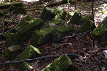
Collapsed Chimney, Abandoned Farm
Sand Island, Apostle Islands National Lakeshore
(William Cronon)
If you want to see a ghost landscape, let a place haunt you.
Walk that place repeatedly; watch it over time; read old maps and accounts of its history. Go to cemeteries; notice residues and ruins. Seeing a ghost landscape means not only learning to recognize the features that mark a road, building, or settlement now abandoned, but also intuiting that change as a loss, even if not a personal one. Remnants tell of a present that is missing something as well as of an absent past. (Michelle Niemann)
To read the landscape, look for ruins.
Ruins are the faded records of the past still apparent on the landscape. Look for building ruins. Sometimes they remain partially or even wholly intact for long periods of time, depending on the environmental conditions of the area, the material of which the building was made, and the human demand for the land or materials for other uses. Look for unusual shapes in the landscape, or strange stone piles or berms. Chimneys are also common. Ruins are also holes in the ground, the remains of basements or cellars. Machinery, automobiles, and boats find their way to ruin eventually, the metals gradually consumed by rust. Infrastructure ruins range from old bridges, roads, and railways, either as the remains of the material, or the imprint of the material on the landscape, as with railroad beds. (Genya Erling)
Explore cemeteries.
Cemeteries contain a wealth of cultural information, and can reveal insights about both the history of human habitation on the land and also of the changing demographies of those communities. A small family plot in an overgrown forest tells a very different story than the orderly rows of graves in a churchyard in town. The graves themselves are clues to the human history of the region; Puritan gravestones look very different than those of Jews. The graves of important social and political figures are often distinguishable because of their design or placement. Pay attention to artwork and motifs, the kinds of names on the stones, and the dates of birth and death; clusters of deaths may indicate regional experiences with disease, war, or disaster. The graves of veterans as far back as the American Revolutionary War are still decorated with flags. Exploring cemeteries is a quick and simple way to be exposed to a range of cultural insights about the past human habitation of a particular place. (Jacquelyn Gill)
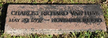
Gravestone of Charles Richard Van Hise
Originator with Robert La Follette of "The Wisconsin Idea"
and Author of Early Textbook on Natural Resource Conservation
Forest Hill Cemetery, Madison, Wisconsin
(William Cronon)
Monuments perform an array of crucial functions , and you can follow these simple guidelines when you want to use them to read the landscape.
Since antiquity, communities have used certain sites to commemorate, mourn, remember, and reflect in various ways. When approaching one of these places—be it a statue, grave, mound, or simple stone tablet, it is helpful to ask how it is situated in relation to the people who live and work near it. Its relationship in space to other sites of meaning to the community will reveal the kind of power the monument yet retains, disclosing its enduring force in the community’s collective telling. If you can, also try to identify what exactly the monument’s function is. What does it seek to remember, celebrate, or mourn? In answering this question, you’ll be clued into a complex set of values, morals, and beliefs central to both past and present actors. After all, those who today allocate resources for the monument’s maintenance and protection see some value in keeping this element of the landscape stable, but they also see some need to keep the meaning of the past—at least in this particular version of its telling—alive as well. As a site of deep meaning, the monument is a treasure trove of information for those who want to trace changes in the land over time. (Jesse Gant)
Consider the relation between monuments and politics of memory
Monuments as an important element of landscape can offer evidence of social values, and therefore convey memories about the past as well as expectations for the future. Although not necessarily always seen as a monument, a place like Forest Hill Cemetery in Madison, Wisconsin, reminds visitors of people in the past who shaped Madison with their actions and values. Particular historical narratives conveyed by monuments also raise questions about the politics of memory. It is always worth asking about memories that may have been forgotten and how the return of those erased memories can change the ways we think about modern landscapes. (Po-Yi Hung)
Andy Goldsworthy, "Stone River"
Aspen Institute, Aspen, Colorado
(William Cronon)
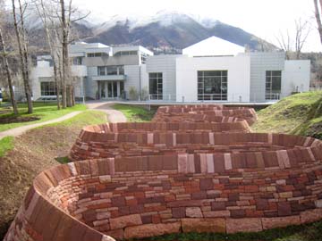
Landscapes can be unique places to create art.
Known as “earthworks,” these sculptural or performance based artworks are typically created in natural settings. Artists reference place and time, and accentuate the geographic, sublime and ecological affects of nature—or in contrast, man’s dominance over nature. Projects can be both human and industrial in scale. When visiting a site, make sure to investigate the area’s previous land use as many are built on former mining or waste sites. When analyzing an earthwork, treat it like any other piece of art in a museum or a gallery. However, you should also consider why the artists chose the site and whether the piece accentuates the landscape and its natural forms or imposes a non-organic structure on nature. The earthworks movement which began in the United States in the late 1960’s is exemplified by artists such as Christo and Jean Claude, Walter De Maria, Robert Smithson and Andy Goldsworthy. (Liese Dart)
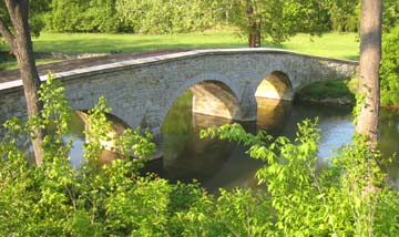
Antietam Bridge, Antietam Battlefield
(site of bloodiest day of fighting in American history)
(William Cronon)
If you ever find yourself on a Civil War battlefield and want to learn about the place by reading the landscape, follow these simple suggestions.
First, walk the battlefield on foot, and try to do so in the way that the battle unfolded. Doing so will give you an appreciation of many things: namely, how the commanders reacted to conditions on the ground, how the landscape itself shaped that process, and how objects on the landscape, if they do exist, sometimes lie. Second, in a related sense, remember to pay attention to general movements of the land, the stuff of permanence. Remember that tree lines, trenches, earthworks, and rock formations have had to endure changes wrought by many generations of visitors, veterans, and developers. In fact, even those who participated in the battles sometimes returned to places only to find that certain trenches, woodlots, and other markers had dramatically changed—countless debates raged throughout Reconstruction over precisely where bodies could be found, exactly where certain regiments fought, and so on. Third, follow the bodies. Careful attention to the dead—the labor of burying them, the politics of their remembrance, the impact of so much rotting flesh on local natural systems—remains as an unpleasant but valuable way of learning about US history while becoming familiar with the importance of changes in the land. (Jesse Gant)
See the shadow of a New England forest's human history cast on its trees and rocks.
Rock walls are a bizarre yet common sight in the forests of the northeast United States. If you find one, pay attention to the size of rocks, because they can tell you what kind of field once lay within their bounds. A farmer would only have wanted to pry from his land as little of this glacial debris as necessary. So if you see a wall of only large rocks, you're probably looking at a pasture: the animals would be contained and the grass would happily sprout from the stony soil. But if you see a wall filled in with small field stones, often dumped in between the larger rocks, you've found a crop field. While northern forests were cleared for pasture and tillage, often the trees on the perimeters of fields were left standing, and so a conspicuously old tree amid younger trees might signal an old fencerow. Planted trees, like fruit trees and sugar maples (don't forget to look for old tap holes) were often situation in easily accessible places like roadsides. (Brian Hamilton)
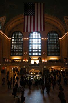
Grand Central Station, New York City
(William Cronon)
One of the best ways to read the landscape of New York City, oddly enough, is to leave the place altogether.
The next time you visit New York, ride the Metro North line out of Grand Central Station to the upstate town of Poughkeepsie. Buy a round-trip ticket at Grand Central Station and board a train before noon on the day of your travels. Take note of your environment--emphasizing place names-- within the confines of Manhattan. Massive amounts of cultural, economic, political, and social information will come at you from all directions. But don’t be alarmed. Board the train, take a seat, and enjoy the ride. The line will make its first stop at 125th street in Harlem. There, from your window, you can see a drastically different neighborhood from the one where you left. Make a note of the place names you see—use them to research the things you’ve seen once you get home. From 125th Street, your car will wind its way through the Bronx, giving you ample opportunity to see all kinds of urban infrastructure, housing, and waterways. The train will then wind its way up the Hudson valley only a few feet from the water’s edge, giving you a bird’s eye view of not only the river and a classic romantic American landscape, but also the developments along the way, including historic mills, train stations, forts, and other structures from times past. Using your notebook, jot down all the destinations, places, and landmarks you see. Use those names to enter into virtually every conversation about the US landscape you might one day have. When you reach Poughkeepsie, turn around and make the return back into the city. The whole trip will only take you a few hours. (Jesse Gant)
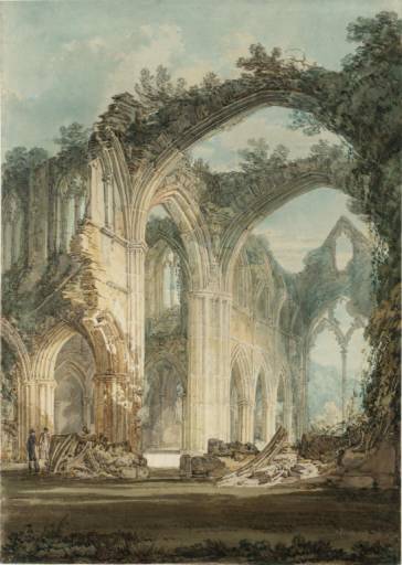
J. M. W. Turner, "Tintern Abbey"
(source: Wikipedia)
Read the Landscape through Poetry.
Consider the way Wordsworth’s famed poem ‘Lines Composed Above Tintern Abbey’ presents a landscape. In that poem, the poet writes
I see
These hedgerows, hardly hedgerows, little lines
Of sportive wood run wild; these pastoral farms,
Green to the very door; and wreaths of smoke
Sent up, in silence, from among the trees!
With some uncertain notice, as might seem
Of vagrant dwellers in the houseless woods,
Or of some Hermit's cave, where by his fire
The Hermit sits alone.
These beauteous forms,
Through a long absence, have not been to me
As is a landscape to a blind man's eye.
Wordsworth’s description of the landscape is notable not only for the things that it makes to appear, but for the things it conceals or makes to disappear. By claiming that the poem’s smoke comes from the fires of gypsies or a hermit, Wordsworth creates an imaginary cause for a visible phenomenon. What makes this case interesting is that Wordsworth probably knew the actual source of the smoke (trees were being felled to feed industrialism, and the smoke described was most likely emerging from the chimneys of either the nearby foundry or blast furnace). In what ways does Wordsworth’s reading of the landscape, which you might consider either inventive or dishonest, present a more insightful look into the historical, aesthetic, and material functions of the particular landscape in question? In what ways does his reading impede your own reading of the landscape? The lesson here is that reading poetic landscapes can lead you to consider how works of literature produce their own unique landscapes, places capable of being considered independently of the real place that provided the poets with their source material. (Stillman Wagstaff)
Return to Top of Page
|